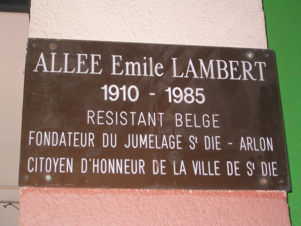
SAINT-DIÉ-DES-VOSGES
(VOSGES)
Plaque de rue à la mémoire
d’un résistant belge
Straatnaambord voor een Belgische weerstander
|
Localisation - Ligging: Allée Émile LAMBERT.
Coordonnées GPS - GPS-coördinaten:
+48°17'11.1", +6°56'54.6"
Inscriptions - Opschriften
"ALLÉE EMILE LAMBERT
1910 - 1985
RÉSISTANT BELGE
FONDATEUR DU JUMELAGE ST
DIÉ - ARLON
CITOYEN D'HONNEUR DE LA VILLE DE ST
DIÉ"
Description - Beschrijving
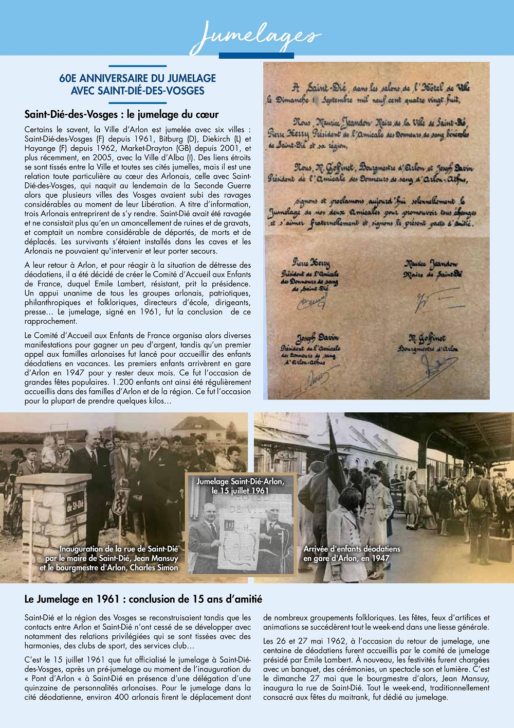
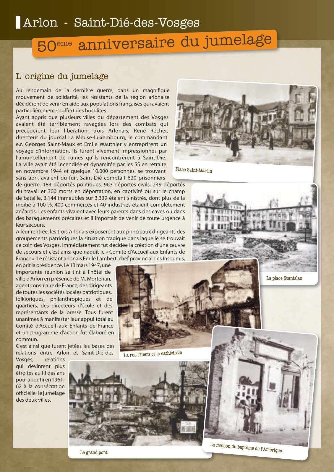
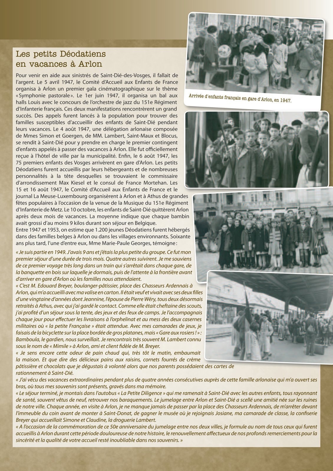
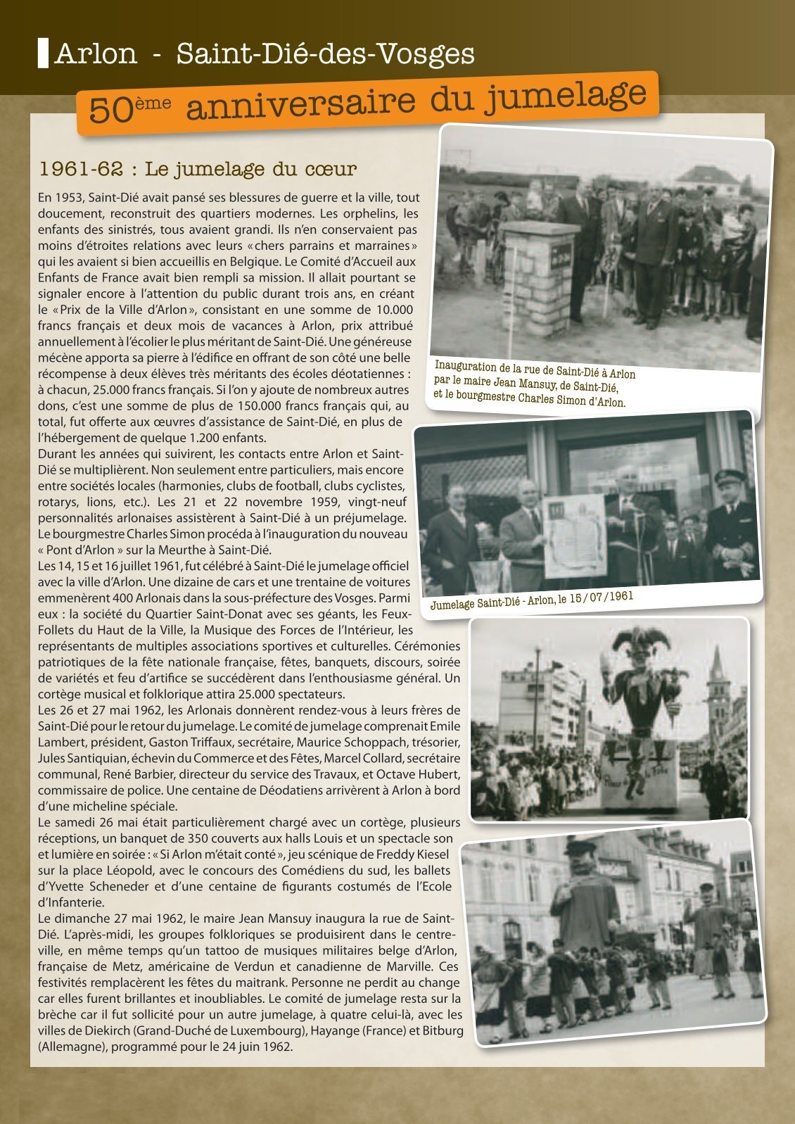
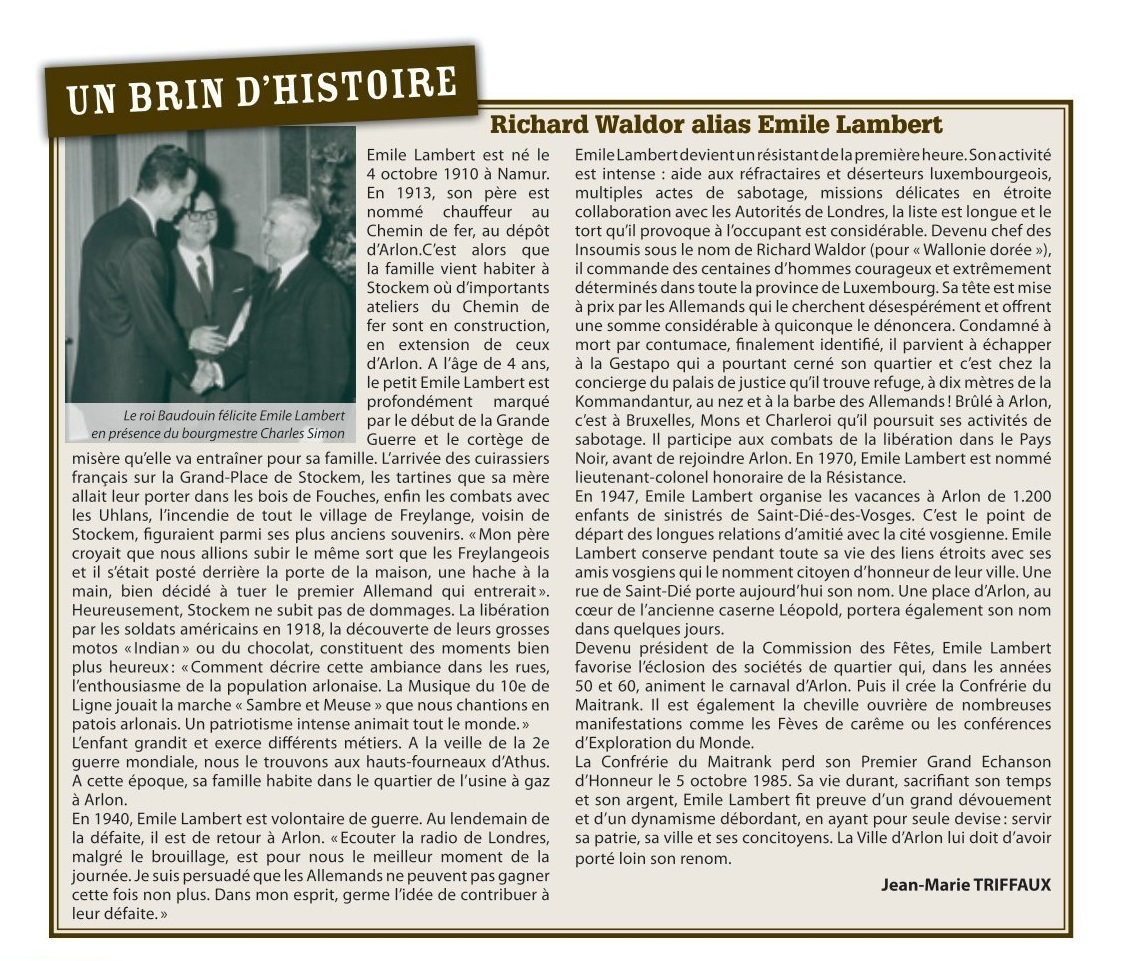
Le jumelage entre Arlon et Saint-Dié-des-Vosges s'est
concrétisé dans les années 1961 et 1962, mais remonte à
l'après-guerre quand Arlon hébergeait, pendant les vacances,
des petits Déodatiens sinistrés.
Plus d'informations concernant cette personne - Bijkomende
informatie over deze persoon
|
Source - Bron : [25]

Télécharger les images pour les visualiser dans une résolution plus élevée